Thursday, March 17, 2016

Arthurs Pass National Park

We made it to Arthurs Pass National Park on February 20 and had about a week to spare before we needed to be in Christchurch for our flight. Arthurs Pass is located inland, between Christchurch on the east coast and Greymouth, on the west coast. The park is in the heart of the Southern Alps. We found a free campsite about 15 km outside of town - we never had an issue hitching into town when we needed to. 

We got to the National Park right after a big storm, so we took the advice of the rangers and decided to hike from the Edwards hut to Howden Hut via Tarn Col. We immediately had to cross the river three or four times. It usually is only up to this shins, but for us the cold water was up to our waist. Thankfully it was warm and sunny out. The first hour into the hike was along with river bed with wonderful views of the peaks. Marcin and I both agreed that it reminded us of Alaska. 


We left the river bed and climbed about 1,000meters to get above the bushline. Once above the bush, we had wonderful viewsnof surrounding peaks and our home for the night, Edwards Hut. We shared the hut, and the trail, with just one other person. After the busy tracks we have been on, this is a nice change of pace. 


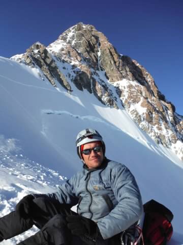
Day two was a longer and more difficult day but well worth the work for the spectacular mountain views we got. We left Edwards Hut in the cold morning and quickly learned it would be a wet walk to the pass. We crossed a number of creeks and rivers, there was no point in keeping our boots dry. We walked over a giant scree slope that had fallen from a mountain aptly named "Falling Moutain". The rock debris was triggere by a large earthquake in 1929. The Department of Conservation staff warned us that there would be no trail markers in this area, but ww had no problem route finding becaise there were cairnes to guide us along with way. You'd really have to try to get lost here. 


We started climbing up the pass, which was very steep. We scrambled up a small waterfall and finally topped out. The pass was calm and, of course, beautiful. 


We had a quick lunch and made our way down to the valley. Passed the Tarn Col and were disappointed that it looked uninviting for swimming. But as we made our way down the creek we went swimming in Otehake River, which was refreshing. 

We walked up another pass that wasn't as steep. The trail took us back down to the creek and then up again and around two beautiful waterfalls, a surprising find towards the end of our day. 

Howden hut was a new and large hut- 20 bunks and with just three people this hut felt too big. 
Lots of room to read and eat. 

views from the hut

The hike out just seemed long. It was mainly walking out on a 4-wheeler trail along the river, so it was pretty boring. 

Since the track was only 3 days we still had a few more days to spare. There are huts in NZ that are considered historical huts, many of which were used for sheep herders. These huts are generally free and full of character. Since the weather wasn't so good on one side of the park we decided to make a short treck to Bealy Spur and stay the night at the old hut. 


The views from the spur was wonderful and the company at the hut made for a fun evening. 

Our last day in Arthurs Pass National Park we hiked the very windy Avalanche Peak right in town. This was probably my favorite National Park in NZ because it was so easy to get up and out of the bush. 


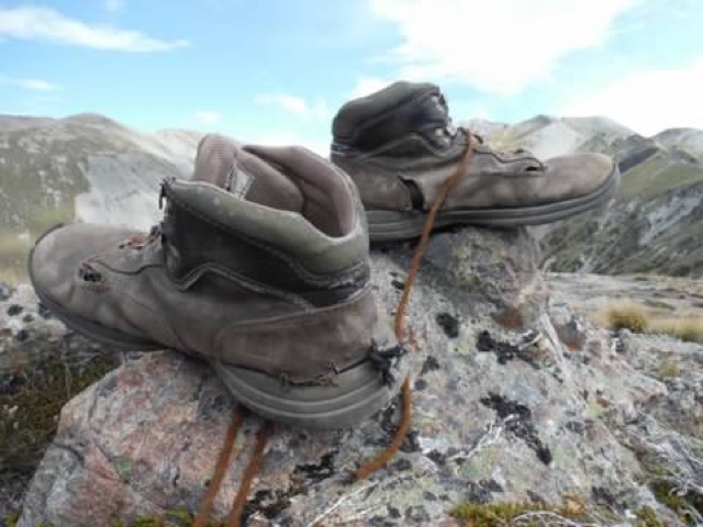
We had a great time hiking in NZ. We were sad to leave but our feet (and boots) could use a rest. We had big plans in Australia and were excited to catch up with an old friend in Melbourne and for some down time! Thank you New Zealand for the beautiful mountains, ocean views, convenient huts, and wonderfully kind people! I am
certain we will be back. 


Wednesday, March 9, 2016

The Great Walks - The Abel Tasman Coastal Track


Marcin and I were a little unsure of The Great Walks. The Great Walks in New Zealand are "premier tracks that pass through diverse and spectacular scenery. From native forests, lakes, and rivers to rugged mountain peaks, deep gorges and vast valleys", according to the Department of Conservation. In other words, the tracks are crowded with tourists groups, school groups, and any other groups you can think of. They aren't the type of hiking trail we normally like to go on.

We had plans to get on the Routeburn Track but it was totally booked until March. We were looking into it in late January. Since we couldn't get on that track we decided to hit the Caples Track, which was a pleasant walk in the same area as Routeburn, just one valley over. We started this track where the Routeburn ends and turned off at the last hut of the Great Walk. We were amazed by the conveniences of the hut - running water, FLUSH toilets, and 28 bunks in this large hut. This is why we were unsure of setting off on a Great Walk - it just didn't seem right to have flush toilets on a hiking trail.


 A paper plate version of my sister was carried everywhere in NZ. It is a family tradition, kind of. Anyway, this was at the pass on the Caples Track. 

 
Having Lunch at the Saddle 

Our uncertainty for Great Walks quickly blew over when we learned more about the Abel Tasman Coast Track. This 3-5 day track follows the northern coast in Abel Tasman National Park. The track is an easy coast walk - with a couple sections of planning due to tide changes. We were thinking of doing just a day trip in and out, but were convinced by a couple of our drivers that the entire walk is well worth the time and trouble. 

We set out early and beat the crowds. We were surprised by the lack of people on the trails. The first sections of the trail were in bush but still had excellent views of light blue sea and golden beaches. The track was more like a road - wide and hard packed. 
On the way out to the Abel Tasman Coast Track!

 
Lovely views along the Coastal Track

 Marcin and I did the treck in three days, because there were limited campsites available. You have to book The Great Walks far in advance, since they are so popular, but we were lucky. Our first camp was at Anchorage Camp (fitting for us). We got there super early in the day, but were happy to lay out on the beach and people watch. This camp is very busy, with water taxis, kayaks, groups, hikers, boaters, you name it! We both thought we would be annoyed by all the commotion at the camp, but being at the beach made us a bit more relaxed, I guess. 

 
 Excellent Views from our first camp

The second day was a bit longer, with a tide crossing that was only accessible at about 8:30 p.m. We started early again to beat the heat. Thankfully on this track we can take a couple hour break and hang out on the beach, if the sandflies don't eat you alive. We were at our campsite by 9:00 p.m.

 
Our view hiking along the golden sand beaches


 One of the many bridges along the track

The last day was just as good. There were a lot less people on the track and on the beaches, which made it feel a bit more isolated. Kayaks and water taxis don't go past a certain point, which makes for some great beach camping and hiking. A word of advice for anyone interested - book Mutton Cove campsite. We weren't able to because it was booked, but it is quiet and small beach camping. Looked inviting. The camping was very convenient, so much so that there were flush toilets and wifi (!!!) at Anchorage Camp. The other camps weren't as crowded, so if you'd like to avoid the crowds, maybe walk further the first day and avoid that area.

Overall, I would say this was one of our favorite hiking tracks. We were surprised how much we enjoyed and and I am glad that we were able to do the track in its entirety.

Crossing the tides

Sunday, March 6, 2016

Nelson Lakes National Park -Roberts Ridge Track

Nelson Lakes National Park is located north of the South island. When we first arrived we experienced a relatively small earthquake. Already an exciting start! We decided to hike the Mt. Roberts Ridge, which follows a beautiful ridge line to a large hut. Here is more information on the Track if your are interested: http://www.doc.govt.nz/Documents/parks-and-recreation/tracks-and-walks/nelson-marlborough/angelus-hut-tracks-and-routes-brochure.pdf

We started early in the morning to beat the heat and to get up to the ridge via the long steep trail in the morning. Once we got up to the ridge, it was, of course, covered in clouds. Thankfully there was an emergency hut where we could wait out the clouds and eat lunch.

Once the clouds dissipated we got some wonderful views. The walk to the hut took about 5 hours and we had views the entire way.We recommend this hike because it was completely out of the bush and the views are spectacular. We were craving a ridge walk and this met our needs.

On the way back out we decided to go towards Speargrass hut, which had more river crossings and the trail was more in the bush. I, of course, fell in the river, back first. Also, a word of advice, be aware of bumble bees in this area. I was stung in the face before it flew directly into my mouth. ugh! They are attracted to blue and unfortunately I was wearing a lot of blue.

Here are a few pictures from the track.


Gillespie Pass and a Broken Ankle


After the Dusky Track Marcin and I were determined to get out of the bush and up in the mountains. We wanted to see some alpine views and good weather. We hitched to Gillespie Pass from Lake Wanaka, which is a gateway to the Southern Alps. We decided to take three days to do the Gillespie Pass Circuit (http://www.doc.govt.nz/parks-and-recreation/places-to-go/otago/places/mount-aspiring-national-park/things-to-do/gillespie-pass-circuit/), which takes you up a beautiful pass, and another detour to an alpine lake.

A rest day in Lake Wanaka


An American named Miles picked us up in his rented campervan and took us to the trail head. As it turns out, he was doing the same hike. We started a bit late, so we hiked in just until the first campsite, which was only about 3 hours in. The temperature, time of day, and access to water made for some heavy, heavy sandfly invasions at the campsite. So we jumped in our tent and called it a night.

Bridge on the Gillespie pass trail

The next day we got up early and hiked another 3 hours to Young Hut. A large hut, with 20 bunks, we decided to stay the night there and just make a day trip to the pass. We were already a bit disappointed with the trail since a lot of it was in the bush, so our expectations were very low.

However, as it turned out, as soon as we left the hut we climbed up to the pass and had some incredible views! The climb was very steep and slow going. But thankfully we had beautiful weather with little to no wind. We got to the pass and took a long break taking photos and just taking in the mountain air. This was much better than the Dusky Track. This is exactly what we wanted.


Mt. Awful looming behind us...

On the way back to the hut we ran into an Israeli couple who were in need of help due to a broken ankle. The ankle was twice the size and he was in pain. Unfortunately, we didn't have a phone or any way to call for help. They had another friend who went to the next hut to see if he could call for help. We were about 30 minutes away from the hut, with a good ankle. Marcin thought that maybe he could help carry the injured man to the hut. It took multiple tries but it was just too dangerous to carry him to the hut. Plus we didn't really need to. He had water, food, and we had an extra tent that we could let him borrow. We stopped at a nice flat spot where a helicopter could easily land and Marcin and I ran back to the hut to grab the tent to lend to them. 

When we got back to the tent, their friend had already called for a helicopter. Marcin took the bright orange fly of our tent and ran back to the injured party and spread it out so the helicopter could easily spot them. A few hours later, they were picked up and taken to the hospital. It was an unexpected end to our day, but it also made me tread a bit more carefully. 


Hitch hiking in NZ

We knew we wanted to focus on tramping in New Zealand, so our usual holiday of cycling was not an option. We were also told the roads were narrow and winding and that the Kiwi drivers were a little less than cautious. Marcin has talked about doing a hitch hiking holiday since our first time hitching in the UK. We hitched a few times successfully in Wales and unsuccessfully in Scotland.

There is no better place than New Zealand to hitch hike. It is safe, people are kind and generous, and, surprisingly, there are a lot of hitch hikers. So on January 16, we packed up everything we needed for the next month and a half in our backpack and started to "thumb it" to the next destination. 

A lot of the drivers that picked us up were Kiwi. Our first couple drivers were farmers . Dairy is New Zealand`s number one business besides tourism. As a result of hitch hiking, we learned a lot about the local economy, the process of dairy farming, local politics, and so much more. The locals gave us advice of what hikes to do and led us to a good place to pick up the next ride. We experienced disappointment from drivers when we said we weren't going too far. Many drivers wanted company on their long and radio-less drives. 

If you or anyone you know are planning on hitching through NZ a word of advice: be prepared to wait few hours on the West Coast. Be patient, it is worth it.  The West Coast holds our record for wait time of two hours. But our average  pick-up time was about 45 minutes. The difference with the West Coast is that the local population is sparse and traffic is mostly tourists. 

But as it turned out, it paid to wait. Dennis picked us up by Haas Pass on the West Coast. He was from England and was traveling alone. He picked us up and was happy to have some company on the road. We accompanied him for the next two days, all the way to our destination of Nelson Lakes National Park! It was a long wait, but worth it to not hitch for the next two days. 


New Zealand has been a great hitch hiking experience for us. Although, I probably wouldn't hitch hike in any other country and am currently happy to have two wheels instead of none, it was a fantastic experience. We were able to meet people from all over the world and learn far more about the country than if we had bicycled. Overall we took one bus out of Christchurch and for the rest of the time we hitched. Again, we waited an average of 45 minutes, but we were usually picked up within 20 minutes.


Tuesday, March 1, 2016

Tramping in New Zealand

Marcin left for New Zealand in December to attempt Mount Cook. This time of year was supposedly the season to climb Mount Cook - spring south of the equator. The route is covered with crevasses, so care had to be taken to follow the right path towards the summit. After about two weeks on the mountain, unfortunately, Marcin and his partner did not summit. But he, of course, vows to be back and plans to go earlier in the season when it is not as warm. 


I did not arrive in NZ until January 16 so Marcin had a lot of free time on his hands. In the mean time he decided to hike a good chunk of the Te Araroa, NZ's Long Trail (http://www.teararoa.org.nz). The trail goes from north to south through both islands and is relatively new.  Marcin completed three weeks on this trail from around Queenstown to Rangitata Gorge on the south Island. He said the trail was a bit remote compared to the other tracks we did.

Te Araroa trail

Fortunately Marcin wasn't alone the whole time. He met up with an Alaska friend and did a week of hiking in Kahurangi National Park. 

A friend of ours recommended the Dusky Track when we asked what are some must-do tramping tracks in New Zealand. So as soon as I got to New Zealand we made a plan to do the 10 day track. The Dusky Track (http://www.doc.govt.nz/parks-and-recreation/places-to-go/fiordland/places/fiordland-national-park/things-to-do/tracks/dusky-track/) is located in Fiordland National Park between Lake Hauroko and Lake Manapouri. In order to access the track in either direction you need to hire a boat to get you there. Unbeknownst to me at the time, the average rainfall for Fiordland is 1200mm to 800mm or about 200 rainy days a year. And boy did we experience rain. 
Some before pictures- before we were wet and muddy. You can already see the uncertainty in my face! 

We started our treck with 6 other people. There was no camping on this trail. The terrain was just to wet, muddy, and rooty (if that's a word) from the trees. The huts are small compared to other tramping tacks - they have a sleeping limit of about 12 people. 

The trail was wet and overgrown. I joked with Marcin that we had better not stand in one spot too long or we would be covered in moss. The trees were huge canopies that created a canyon-like track. The mud and downed trees were consistent throughout the trip. At one point I stepped in mud up to my knees. Since then, I have heard that the track can be worse than what we experienced - mud up to the thighs! The downed trees were another challenge. Due to the weather and unstable earth, there were a lot of trees. It took 10 to 15 mintues to climb through, under, or around these masses of chaos in the middle of the trail. 

One of 6 huts on the Dusky

#hutlife


climbing down some roots
so. much. growth. 

Day two on the track we finally got above the trees. Like I wrote earlier, it was like stepping out of a cave and seeing light again. Granted, it wasn't sunny, not in the slightest. We were lucky though, it didn't really start pouring until we got to the hut. 

This hut was our favorite because of the lack of sandflies. Have I mentioned the sandflies yet? Sandflies are as bad as mosquitoes in Northern Alaska. They bite and you won't even know it until two days later when you are itching incessantly. The little bastards leave welts on some people and can even leave scars depending on how much you itch. For me, the worse was at night when I would itch in my sleep and start bleeding. On the Dusky Track they were the worst. They would be so bad that we had to rush to kick off our boots at the end of the day outside the hut. They relish in muggy weather and around water. It was so bad we were inhaling them. 

The days that followed were rainy. It rained every day we were on the trail. If it wasn't raining it was drizzling. We waited out the third day due to rain and knew there would be a three-wire bridge crossing that had a potential to flood. There are 21 three-wire bridges along the whole trail. It is not always necessary to cross them as you can usually cross the creek if it low and there is good access. But the access to this three-wire bridge was flooded. We had to walk through chest-deep water to get to the bridge and that was just the beginning of pur flooding issues. 

getting to the three-wire bridge
one of the 21 bridges


only views on the track

The next day and night brought torrential downpours. The hut was nestled between a lake and a river. The trail was flooded in all directions. So much so that we read accounts of trampers that didn't wait out the weather and had to swim in sections. 

We waited out the flood for two nights. The water finally receded enough to continue on. The trail was more of the same. There were two passes above tree line that I am sure were beautiful if it weren't for the socked-in weather. We made it out on the 9th day. There are a total of 6 huts on the track or 7 if you decide to do a detour. We wondered why the description said the track can take up to 10 days but now we get it- leave time for floods. 

Overall we both said we wouldn't recommend this track- even if we had good weather. We were eager to get out of the bush and see some views. A majority of the track was in the canopy of trees, roots, moss, and deep dark bush. We were only above tree line twice during the 9 days and we soon found out that a majority of the tracks in NZ were in the bush. 

Overall we completed 7 overnight tracks during my 7 weeks in New Zealand. More to come on the other tracks and our experiences hitchhiking throughout the South Island.